


There are multiple theories out there on how, and why the Lahaina, Maui fires devastated that Hawaiian island two weeks ago. Who started them? Was this a case of arson or neglect? Or was this something far more sinister? Far too many questions about this remain unanswered. Why?
Was this a Direct Energy Weapons (DEW) attack as so many believe? Did China attack us or was it our own government that did this? As horrible as that thought is it may be true!
Publicly the blame is increasingly being placed upon the Hawaiian Electric Company by local government officials and the mainstream media. This version of the story bothers me the most. We have learned over time that when we are quickly given the official narrative, on such short notice after the fact, with events like this, then we know that we are being lied to. I believe that this is the case with this fire.
I don’t have the answers as to what really happened. But I will tell you that I don’t like what I am hearing and seeing. Watch the two YouTube videos attached below and tell me that something bizarre and crazy didn’t happen there. I’m not one to quickly jump onto the conspiracy theory bandwagon but you can’t come to any other conclusion after seeing these videos (and others like them) that whatever happened in Lahaina was not an ordinary brush fire fueled by high winds, and very dry conditions…started by downed power lines.
Still unanswered (as well as many other questions) is what happened to the missing 400-500 children. Are they dead or did something else happen to them? How many people really died in that fire? We are not getting credible answers from local, state, and national officials on this.
Why? What are they hiding?
Which is continuing to fuel the public debate and cause more and more people to look at this and ask “what really happened here and why?”

Cover Video - Greg Reese On Banned Video. His Substack Channel below.
Depopulation, Climate Change, and Weather Weapons
Man made climate change is real
GREG REESE AUG 26, 2023
I’m not sure I agree with everything that Greg Reese is saying in his cover video above. Nor am I saying that I don’t agree with everything he is saying. Given history of the past three years I’ve learned to be a lot more open minded. The one thing I am certain of is that things are not as they seem.
Yes, made climate change is a political hoax and a dangerous one at that. It has become the trojan horse that our own government with the help of others, have in part been able to push their 2030 agenda upon so many. It has become today’s new political religion. All who oppose it are censored; silenced, publically shamed, humiliated, mocked, sued, and in some cases jailed.
Agree with it or not weather and climate have become the new political weapons of war that are being used by these radicals who want to control the entire planet. After these tragedies happen I always ask myself this question…What Next and where?
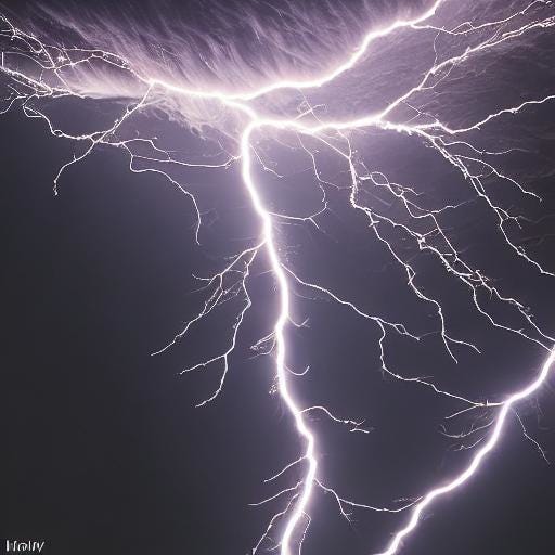
Maui D.E.W: Evidence of Direct Energy Weapon? Judge For Yourself..
MORE EVIDENCE - 2 Miles from Lahaina Fire A Melted Car Surrounded by Gravel! D.E.W. or What?
Tropical Storm Idalia To Rapidly Intensify In the Eastern Gulf of Mexico.


BULLETIN
Tropical Storm Idalia Intermediate Advisory Number 7A
NWS National Hurricane Center Miami FL       AL102023
700 AM CDT Mon Aug 28 2023

...IDALIA FORECAST TO BECOME A HURRICANE WHEN IT NEARS WESTERN
CUBA LATER TODAY...
...LIFE-THREATENING STORM SURGE AND DANGEROUS WINDS BECOMING
INCREASINGLY LIKELY FOR PORTIONS OF FLORIDA...


SUMMARY OF 700 AM CDT...1200 UTC...INFORMATION
----------------------------------------------
LOCATION...20.6N 85.2W
ABOUT 90 MI...150 KM S OF THE WESTERN TIP OF CUBA
MAXIMUM SUSTAINED WINDS...65 MPH...100 KM/H
PRESENT MOVEMENT...N OR 360 DEGREES AT 8 MPH...13 KM/H
MINIMUM CENTRAL PRESSURE...989 MB...29.21 INCHES


WATCHES AND WARNINGS
--------------------
CHANGES WITH THIS ADVISORY:

None.

SUMMARY OF WATCHES AND WARNINGS IN EFFECT:

A Hurricane Warning is in effect for...
* Cuban province of Pinar del Rio

A Tropical Storm Warning is in effect for...
* Yucatan Peninsula from Tulum to Rio Lagartos, including Cozumel
* Isle of Youth Cuba
* Dry Tortugas Florida

A Storm Surge Watch is in effect for...
* Chokoloskee to Indian Pass Florida, including Tampa Bay

A Hurricane Watch is in effect for...
* Englewood to Indian Pass Florida, including Tampa Bay

A Tropical Storm Watch is in effect for...
* South of Englewood to Chokoloskee Florida
* Lower Florida Keys west of the west end of the Seven Mile Bridge

A Hurricane Warning means that hurricane conditions are expected
somewhere within the warning area, in this case within the next
12-24 hours.  Preparations to protect life and property should be
rushed to completion.

A Storm Surge Watch means there is a possibility of life-
threatening inundation, from rising water moving inland from the
coastline, in the indicated locations during the next 48 hours.
For a depiction of areas at risk, please see the National Weather
Service Storm Surge Watch/Warning Graphic, available at
hurricanes.gov.

A Hurricane Watch means that hurricane conditions are possible
within the watch area.

A Tropical Storm Warning means that tropical storm conditions are
expected somewhere within the warning area.

A Tropical Storm Watch means that tropical storm conditions are
possible within the watch area.

Interests along the southeastern U.S. coast should monitor the
progress of this system.  Additional watches and warnings will
likely be required later this morning.

For storm information specific to your area in the United
States, including possible inland watches and warnings, please
monitor products issued by your local National Weather Service
forecast office. For storm information specific to your area
outside of the United States, please monitor products issued by
your national meteorological service.


DISCUSSION AND OUTLOOK
----------------------
At 700 AM CDT (1200 UTC), the center of Tropical Storm Idalia was
located near latitude 20.6 North, longitude 85.2 West. Idalia is
moving toward the north near 8 mph (13 km/h).  A northward motion
is expected through tonight, followed by a faster north-northeast
motion on Tuesday and Wednesday. On the forecast track, the center
of Idalia is forecast to pass near or over western Cuba tonight,
over the extreme southeastern Gulf of Mexico by early Tuesday, and
reach the Gulf coast of Florida on Wednesday.

Maximum sustained winds are near 65 mph (100 km/h) with higher
gusts.  Idalia is forecast to become a hurricane later today and a
dangerous major hurricane over the northeastern Gulf of Mexico by
early Wednesday.

Tropical-storm-force winds extend outward up to 70 miles (110 km)
from the center.

The latest minimum central pressure estimated from data from an Air
Force Reserve reconnaissance aircraft is 989 mb (29.21 inches).


HAZARDS AFFECTING LAND
----------------------
Key messages for Idalia can be found in the Tropical Cyclone
Discussion under AWIPS header MIATCDAT5 and WMO header WTNT45 KNHC,
and on the web at hurricanes.gov/text/MIATCDAT5.shtml

STORM SURGE:  The combination of a dangerous storm surge and the
tide will cause normally dry areas near the coast to be flooded by
rising waters moving inland from the shoreline.  The water could
reach the following heights above ground somewhere in the indicated
areas if the peak surge occurs at the time of high tide...

Aucilla River, FL to Chassahowitzka, FL...7-11 ft
Chassahowitzka, FL to Anclote River, FL...6-9 ft
Ochlockonee River, FL to Aucilla River, FL...4-7 ft
Anclote River, FL to Middle of Longboat Key, FL...4-7 ft
Tampa Bay...4-7 ft
Middle of Longboat Key, FL to Englewood, FL...3-5 ft
Englewood, FL to Chokoloskee, FL...2-4 ft
Charlotte Harbor...2-4 ft
Indian Pass, FL to Ochlockonee River, FL...2-4 ft
Chokoloskee, FL to East Cape Sable, FL...1-3 ft
Florida Keys...1-2 ft

The deepest water will occur along the immediate coast in areas of
onshore winds, where the surge will be accompanied by large and
dangerous waves.  Surge-related flooding depends on the relative
timing of the surge and the tidal cycle, and can vary greatly over
short distances.  For information specific to your area, please see
products issued by your local National Weather Service forecast
office.

Storm surge will raise water levels by as much as 4 to 6 feet above
normal tide levels along the southern coast of Pinar del Rio, Cuba.
Near the coast, the surge will be accompanied by large waves.

WIND:  Hurricane conditions are expected within the hurricane
warning area in western Cuba later today.  Winds are expected to
first reach tropical storm strength by this morning, making
outside preparations difficult or dangerous.  Preparations to
protect life and property should be rushed to completion.

Tropical storm conditions are expected over portions of the
tropical storm warning area over the Yucatan Peninsula and the Isle
of Youth in Cuba through today

Hurricane conditions are possible within the hurricane watch area by
late Tuesday or Wednesday, with tropical storm conditions possible
by Tuesday.

Tropical storm conditions are possible in the Dry Tortugas beginning
late today and within the tropical storm watch area along the
Florida Gulf coast on Tuesday.

RAINFALL:  Idalia is expected to produce the following rainfall
amounts:

Portions of the eastern Yucatan: Additional 1 to 2 inches.

Western Cuba: 4 to 7 inches, with isolated higher totals of 10
inches.

Portions of the west coast of Florida, the Florida Panhandle,
southeast Georgia and the eastern Carolinas: 4 to 8 inches from
Tuesday into Thursday. Isolated higher totals of 12 inches possible,
primarily near landfall in northern Florida.

This rainfall may lead to flash and urban flooding, and landslides
across western Cuba.

Areas of flash and urban flooding, some of which may be locally
significant, are expected across portions of the west coast of
Florida, the Florida Panhandle, and southern Georgia Tuesday into
Wednesday, spreading into portions of the eastern Carolinas
Wednesday into Thursday.

SURF:  Swells generated by Idalia are affecting portions of the
southern coast of Cuba and eastern Yucatan.  These swells are
likely to cause life-threatening surf and rip current conditions.
Please consult products from your local weather office.


NEXT ADVISORY
-------------
Next complete advisory at 1000 AM CDT.

$$
Forecaster Brown
The Truth Is Stranger Than Fiction!
You Want The Truth, You Can’t Handle The Truth!
There Are None So Blind As Those Who "Will - Not" To See!
You Can’t Wake Up - If You Don’t Know That You Are Asleep!

Share this post